Thursday 31 January 2013
Thar Desert
Thar Desert forms the natural boundary separating the two nations of Pakistan and India. Located in the north eastern part of the continent of India the arid region covers more than 200,000 sq km which makes up for the world’s 9th largest subtropical desert. The connotation Great is attached with the Indian Desert due to its sheer immensity and area of coverage.
Location Map
The desert covers a massive area and spreads after the River known as Sutlej and Aravalli range encompasses the region on the eastern side of the desert. The salt marshes of the great Rann ok Kutch which covers a part of the Thar on the south and the River Indus on the west. The huge thorny streppe at the northern side of the area is not well marked out.
The majority of the desert lies mostly in the State known as Rajasthan which covers the north western side of India and overlaps into northern Gujarat state and covers some of the areas especially in the southern part of the state of Gujarat.
The desert also stretches into the area of Pakistan and fills the south eastern part of the province of Punjab where it connects with Cholistan, a desert which is located close to Bahawalpur, and the eastern Sindh project.
Photo Gallery
 |  |  |
Kutch Desert
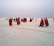
The Rann of Kutch is considered to be the most splendid salt marsh. It is seasonal and is situated and covers a negligible part of south western part of Pakistan, the province of Sindh. In India it is is a part of the Thar Desert, located in the district of kutch, which is situated in the State of Gujarat. Covering a mammoth area of about 7505.22 square kilometers (2897.78 sqm ) is considered to be the largest salt desert in the world. The astounding place is dwelled by the kutchi people.
The source of the word ’Rann’ can be traced back to the rig Vedic period and Mahabharata when the word signified run meaning desert.
The monsoon season of India transform the place into a thriving breeding ground for the flamingoes. The mudflats and the salty sticky clay are filled with stagnant water punctuated from time to time with sandy islets comprising of thorny scrub. The land stands at an average of 15 meters above the sea level.
The Rann of Kutch is the home to some exotic and rare species of the world. Well renowned for the Indian Wild Ass sanctuary, it is the dwelling place of the last three species of the Asiatic wild ass (Equushemionuskhur or khar). These species are the unique and the sole ones which still inhabit the area along with jackals, foxes, nilgai antelope, chinkara gazelles, foxes and blackbucks. It is the sole place in all of Pakistan and India which witness the migration of scores and scores of flamingoes. It is also characterized by the presence of thirteen species of larks that harbors.
For the preservation and protection of the species of animals and birds against poaching the area id diligently and regularly patrolled by the birder security force (BSF). The land beyond the India bridge is a long stretch representing pure white replica of snow with intermittent deposition of salt crystals. The endless miles of white sand which stretches beyond infinite can spell a cast on the viewer who will be enchanted with the whole scenario of the desert.
Location Map
The Great Rann of Kutch as it is popularly known as, with the Grasslands known as Banni covering the fringes of the south. The Rann of Kutch in addition with the little Rann of Kutch is located in the district of kutch and incorporates some 30000 square kilometers between the areas of gulf of Kutch and outlet of the Indus river in southern part of Pakistan. The mash can be entered from Kharagoda, a village in the district of Surendranagar. During the Indian summer monsoon the incessant rain causes the whole stretch of the Kutch to get filled with water and is inundated. Hence the colossal distance of the land stretching from the Gulf of Kutch on the west and gulf of Cambey on the east get consolidated during the monsoon.
Photo Gallery
 |  |  |
Upper Wardha Dam
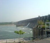
Upper Wardha Dam is known for its straightness in earth filling due to its gravity power. In the small district of Maharashtra state called Amravati, a Godavari river flows to which the Wardha River pay its tributary as a part of it. The water from this dam is used for multipurpose activities such as for drinking water, for irrigation, for generating the hydropower etc. According to the famous love story of Nala and Damayanti in the mythology of Hindu, this dam also comes to known by the name Nala Damayanti Sagar. Upper Wardha Dam act as the lifeline to the people of Amravatiand the other districts situated with it. This dam is well known for the supply of water to the industries located and to supply the water for drinking.
Geography
It is known that the Wardha River flows to give the tributary to the river Godavari. This dam has been spread over an area of 785m (2575 ft) in altitude which is a large area.
It covers almost half the portion of Multai Plateau in Satpura range which is located in the small district of Madhya Pradesh. Wardha River flows in the districts of Madhya Pradesh and after covering the distance of 32km, it has entered into the state of Maharashtra at a place nearer to Satpura Range. It used to cover almost half of the Wardha district from its North and remaining from the west side. Wardha River later on joins the Wainganga River ater covering the distance of 528 km (328 mi). The combination of both the rivers is known as the Pranhita. Pranhita covers the Godavari River, Erai and many more from its left side which give the tributary from the left side and the river like Penganga used to give tributary from the right side.
Government has opened this project for about 8km away which is far away from Morshi to the east side and a distance of 56km from the small town of Amravati. It is calculated that river has a catchments area of about 4,302 km sq (1,661 sq mi).
Photo Gallery
 |  |  |
Ujjani Dam
There is a project that started on the Bhima River and the name of that project was Ujjaini Dam. The alternate name of this dam is Bhima dam. It is also known as Bhima Irrigation Project. Through this name, large number of people knows it in the area where the dam is located. This dam is constructed on the subsidiary of Krishna River and it is located in the area of Ujjaini Village which is located in the Solapur district. It comes under the Madha taluk of that state of Maharashtra. The river of Bhima originates from the Bhimshankar which is in Bhimshankar Ghats. Then it forms a valley of Bhima Valley and it also forms its tributaries. On its tributaries and including the main river, there are 22 dams built and along all of them, Ujjaini Dam is the main primary dam. It is the largest dam in the valley with having a total area of 14858 kilometres square. The construction was started in the year of 1969 of this dam including the other canals which are associated with it. These canals are located at both banks and the total cost of constructing all these things include Rs.400 million and it got completed inthe year 1980. The total cost which the construction period took was Rs.3295.85 million.
There is a earth cum gravity concrete dam is created on the River Bhima through which people are getting support in large number of ways. This reservoir is having annual utilization of large number of water which is mainly for irrigation to the land which is ready for agricultural purpose. Also it provides help to the district of Solapur in getting the drinking water, water for hydroelectric projects, water for fishes and also for various industries which are established in that area as well.The water which is stored in the reservoir is very helpful for the people during the situations like drought that happens in large number in this area. Through this reservoir, people also get restrictions among threats of floods and it also serves for the same purpose to the village of Paqndharpur.
Photo Gallery
 |  |  |
Tilaiya Dam
The Tilaya Dam mainly covered the upper reaches portion of Barakar River of 64.4 kilometres (40.0mi) from its source to the downstream. A narrow Gorge of about 91.4 metres (300 ft) is set up across the river which allows the river to pass through the narrow gorge which makes it cover its each side by 45.7 metres (150 ft). Tilaiya dam is set up in the area which mainly includes forests, waste lands, cultivated lands etc which means about 984 sq km (380 sq mi) of area is work as the catchment area for the dam. According to the weather department, this area receives the 127 centimetre of rainfall annually.
With its maximum height of about 30.2 metres (99 ft), Tilaiya dam is considered one of the gravity dams over the river bed. Tilaiya dam is one of the dams which have maximum discharging capacity of 3852 m cube/s with the help of 14 tainter type crest gates which is of size 3.05m x 9.1 m.The water from Tilaiya dam is used to supply water for the irrigation purpose during the dry season.
In the year of 1953 dated 21st February, Tilaiya dam was inaugurated. It is considered one of the power generators which provides a capacity of 2 x 2 MW.Its become the eye-catching site for those who are passing to the Grand Trunk Road of Barhi which is known by (Patna- Ranchi) road.
Photo Gallery
 |  |  |
Tehri Dam
The renowned Tehri Dam project is a multi-purpose hard stone as well as mud-fill embankment local dam at the renowned Bhagirathi Stream close to renowned Tehri in the state Uttarakhand in the country of India. It is an important main dam of government THDC India co.Ltd. As well as the local Tehri wave complicated. Stage 1 was finished in the year of 2006; the renowned Tehri Dam withholds a tank for watering, public drinking water and the creation of around 1,000 MW of useful hydroelectricity. One more venture of the set up potential of about 1,000 MW injected storage space hydroelectricity are under development.
History
An initial research for the renowned Tehri Dam Venture was greatly finished in the year of 1961 and its framework was finished in the year of 1972 with around 600 MW potential energy flower depending on the research. Development started in the year of 1978 after practicality research but it was late just because of economical, ecological and public effects. In the year of 1986, specialized and economical aid was offered by the U. S. country of Indian the project and at first, it was placed under the route of the Watering Division of state Uttar Pradesh, India. However, in the year of 1988 the government, about 25% by local State of Uttar Pradesh could fund the whole irrigation aspect of the project. In the year of 1990, the renowned project was reconsidered and the style modified to its present high multi-purpose. Development of local Tehri Dam area was finish in the year of 2006 while the second aspect of the project, the renowned Koteshwar Dam, was finish with two out of four turbines functional. The other two are required to be requested in the month of March 2012 season while the injected storage space energy organized is scheduled for commissioning in the month of Feb 2016 season.
Photo Gallery
 |  |  |
Srisailam Dam
In the small district of Andhra Pradesh mainly call as Kurnool district, a Srisailam dam is constructed across the river Krishna. Srisailam dam is considered to be the second largest hydroelectric project of the government in the country.
In the deep gorge of Nallamala hills, this dam was constructed which is mainly 300 m above the sea level. Srisalam dam is mainly of 512 m (1680ft) long and 145 m (476ft) high which let it to have 12 radical crest gates. It mainly includes a limited number of reservoirs of 800 km2 (310 sq mi) under it. It has mainly two power stations, left bank power station houses which is 6x 150 MW and used as a Francis-pump turbines and the right bank power station house which contains 7x 110MW which used as a Francis-turbine generators.
Government has acclaimed Srisailam dam as the India’s twelve largest hydroelectric plan. Srisailam dam also become the tourists spot for those who are nature lovers. Due to its beautiful backdrop of Nallamala hill ranges and the flow of river Krishna made it an attractive spot.
Photo Gallery
 |  |  |
Sardar Sarovar Dam
| Country | India |
| Location | Navagam, Gujarat |
| Coordinates | 21 49'49"N 73 44'50"E Coordinates : 21 49'N 73 aa'50"E |
| Status | Operational |
| Owner(s) | Narmada Control Authority |
Dam And Spillways
| Type of dam | concrete, Gravity |
| Height (foundation) | 163 m (535 ft) |
| Length | 1,210 m (3,970 ft) |
| Impounds | Narmada River |
| Spillway capacity | 84,949 m3/s (2,999,900 cu ft/s) |
Reservoir
| Capacity | 9,500,000,000 m3 (7,701,775 acre-ft) |
| Active capacity | 5,800,000,000 m3 (4,702,137 acre-ft) |
| Catchment area | 88,000 km2 (34,000 sq mi) |
| Surface area | 375.33 km2 (144.92 sq mi) |
| Normal elevation | 138m (453 ft) |
| Reservoir length | 214 km (133 mi) |
| Max Reservoir width | 16.10 km (10.00 mi) |
Power Station
| Operator(s) | Sardar Sarovar Narmada Nigam Limited |
| Commission date | June 2006 |
| Turbines | 6 x 200 MW Francis pump-turbine |
| Canal | 5 x 50 MW Kaplan-type |
| Installed capacity | 1,450 MW |
The Gravity dam Sardar Sarovar Dam is located on the Narmada river just near Navagam, Gujarat State, India. This is the biggest dam and also is a part of Narmada River Valley Project, a great hydraulic engineering project which involves construction of an array of huge irrigation and multipurpose hydroelectric dams at Narmada River. This project was taking its form in 1979 and was a major part of development scheme for increasing irrigation and formation of hydroelectricity.
Planned at the Narmada, this one is 30th biggest dam, Sardar Sarovar Dam (SSD) is the biggest structure that has been built. Since its foundation its height is proposed to be of 535 feet (163 m). The project has a plan of irrigating more than 6,900 sq mi (18,000 km2), a large part in various drought prone areas of Saurashtra and Kutch. Main power plant of the dam is house to six Francis pump-turbines of 200 MW for generation of electricity affording a storage pump capability. In addition, another power plant at intake for main canal holds five Kaplan turbine-generators of 50 MW. Power facilities are having a total installation capacity of 1,450 MW. It is critically maintained that various negative impacts simply outweigh over its advantages.The project has created a discord between the citizens group Narmada Bachao Andolan and its government planners.
Photo Gallery
 |  |  |
Salaulim Dam
The renowned Salaulim Dam (also written Selaulim or Saluli) located on the popular Salaulim Stream, a branch of the Zuari Stream in the state of Goa, Indian, is a vital part of the renowned Salaulim Watering Venture, which envisages benefits of irrigation, and consuming water. The dam is a blend earth-cum-masonry dam of about 42.7 meters size with water propagates area of 24 kilometers. the popular dam was originally organized to provide irrigation to an greatest prospective of around 14,326 hectares ( or total 35,400 acres) and water of about 160 thousand liters per day ( or MLD) to Southern Goa; the water element for household and commercial use is now improved to around 380 MLD. The initial price of the project when accepted in the year of 1971 was INR 9.61 crore that, as of 2007 season, is approximated to price INR 170 crores Indian currency. Development of the project was however started in the year of 1976, the renowned dam was greatly finished in the year of 2000 year as well as the important irrigation element is under final levels of achievement having obtained an irrigation prospective of about 9,537 ha, as of the year of 2007.
Geography
The renowned venture is situated at local Sirga area about 5 km distance from the renowned Sanguem city, in popular Zuari Stream Container, which is cleared by the local Zuari Stream which will is established after the confluence of renowned Selaulim which is also written Salaulim and local Uguem Waterways in local Sanguem village. The renowned Salauilm area dam is situated on the local Selaulim Stream, which is also known as local Sanguem just near the local Sanguem city. The stream empties a catchments place of around 227 km.
Photo Gallery
 |  |  |
Rangit Dam
The renowned Rangit dam project, which types the headwork’s of local Rangit Wave Energy Venture Level third, is an important river power project on the local Ranjit Stream, a significant main tributary of the popular Tista Stream in the Southern Sikkim region of the East Native Indian states of small Sikkim. The amazing designs' development was finished in the year of 1999.The project is complete since the year of 2000.The project was also designed at a price of around INR 4922.6 million or about INR 492.26 crores.The normal yearly power creation from the renowned project is around 340 GWh with company power total 29 MW.
Photo Gallery
 |  |  |
Rana Pratap Sagar Dam
The renowned Ranapratap Sagar pond or Dam is one of the severity brickwork dams of around 53.8 meters ( or total 177 feet) size designed on the local Chambal Stream at the area of Rawatbhata in the state of Rajasthan in the country of India. This renowned dam is an important aspect of incorporated plan of a local stream growth of the stream including four tasks beginning with the local Gandhi Saagar Dam or pond.The Gandhi Sagar pond is located in the upstream arrive at (total 48 kilometers (or about 30 miles which, upstream in state Madhya Pradesh. The renowned Jawahar Sagar pond or Dam on the downstream (total 28 kilometers (or about 17 miles) downstream along with a terminal framework of the local Kota Onslaught (around 28 kilometers (or total 17 miles) further downstream in the state ofRajasthan for watering.
The immediate advantage from the local dam is wave power creation of around 172 MW (or with main four important models of about 43 MW prospective each) on the local dam toe leader adjacent the spillway.It produces obtained from the local Gandhi Sagar pond or Dam and the extra storage space designed at the dam by the intercepted catchments place.The approximated creation prospective of around 473.0 GW of creation is surpassed in most decades since its commissioning.The energy place was formally announced start on the date of 9 Feb in the year of 1970 by former Prime Minister Indira Gandhi.The local dam and energy flower are known as after the enthusiast great king Ranapratap of state Rajasthan, county India
Photo Gallery
 |  |  |
Pong Dam On Vyas River
The renowned Pong Dam, which is also called dam Beas, is an important earth-fill embankment Indian dam at the local Beas Stream near upstream of local Talwara area in the condition of state Himachal Pradesh, India. The main objective of this dam is water storage space for watering and wave energy creation. As an important second stage of the local Beas Venture, development on the renowned dam was started in the year of 1961 and was greatly finished in the year of 1974. At enough required duration of its achievement, the local Pong Dam area was the highest of its kind in the country of India. The local stream designed by the renowned dam, local Maharanapratap Sagar area, became a highly well known bird speciessanctuary.
Background
An important concept for this dam on the local Beas on the Pong area was very first suggested in the year of 1926 and following reviews of the renowned Indus Stream and its some tributaries were requested by the state Punjab Govt in the year of 1927. Great Attention in the local dam dropped after the review considered the venture challenging just because of Overflow Ocean. In the year of 1955, geological as well as hydrological researches were greatly performed on the local Pong area and an embankment style was greatly suggested.In the year of 1959, comprehensive research was performed that suggested an embankment local dam with a severity area.Any kind of style was released and development started in the year of 1961 on the local dam, which was only the second-phase of popular Beas Project, and the renowned Pandoh Dam around 140 km (or total 87 miles) upstream being very first. It was also finished in the year of 1974 and the energy place was later requested during the time of 1978 to the year of 1983. According the reports, around 150,000 individuals were removed by the local dam's huge tank under a badly organized and implemented transfer system.
Pong Dam
| Country | India |
| Location | Talwara |
| Coordinates | 31°58′17″N 75°56′48″E |
| Status | Operational |
| Construction began | 1961 |
| Opening date | 1974 |
| Owner(s) | Management Board of Bhakra Beas |
Dam And Spillways
| Type of dam | Embankment, earth-fill |
| Height | 133 m (436 ft) |
| Length | 1,951 m (6,401 ft) |
| Crest width | 13.72 m (45 ft) |
| Base width | 610 m (2,001 ft) |
| Volume | 35,500,000 m3 (46,432,247 cu yd) |
| Crest elevation | 435.86 m (1,430 ft) |
| Impounds | Beas River |
| Spillways | 6 x radial gates |
| Type of spillway | Overflow gated chute |
| Spillway capacity | 12,375 m3/s (437,019 cu ft/s) |
Reservoir
| Creates | Maharana Pratap Sagar |
| Capacity | 8,570,000,000 m3 (6,947,812 acre·ft) |
| Active capacity | 7,290,000,000 m3 (5,910,099 acre·ft) |
| Catchment area | 12,560 km2 (4,849 sq mi) |
| Surface area | 260 km2 (100 sq mi) |
| Normal elevation | 426.72 m (1,400 ft) |
| Reservoir length | 41.8 km (26 mi) |
Power Station
| Commission date | 1978-1983[3] |
| Hydraulic head | 95.1 m (312 ft) |
| Turbines | 6 x 60 MW Francis-type |
| Installed capacity | 360 |
Pong Dam has its another name known as Beas Dam, it is a dam which is earth-fill in nature on the River of Beas which is just on upstream of the Talwara which is situated in the Himachal Pradesh in the country India. The role of the dam is to store water in order to produce hydroelectric power and irrigation. Second phase of this project was started in the year 1961 which was completed in the year 1974.This dam was considered as a tallest dam when it was completed. The lake which was constructed is known as Maharana Pratap Sagar which is now a famous bird sanctuary.
The reservoir known as Maharana Pratap Sagar which is situated in Kangra is forty two Kilometers in length and two kilometers in breadth. This dam is a famous place for sailing, canoeing, rowing, kayaking, surfing and Water-skiing etc.
This dam’s Wetland Sanctuary is spread in the area of 40 kilometers and is considered as a biggest sanctuary of fresh water in the country having an area of water of 475 Sq. Km. This place is considered as heaven for migratory birds and for residents as there are various numbers of aquatic fauna as well as this place is also in the list of important international ecological foundations.
According to the description given by the locals, Pong Dam provides unique varieties and landscape. Technically speaking Pong Lake situated near it is about 475 sq. mt. huge. The various spotting opportunities provided by his lake are fishing that could be done in the depth of water to loams of soil.
There are 27 types of species of fishes which are from Gloden Mahseer as well as to Rohu. This Pong Dam is an excitement place for those people who like coarse angler and fishing.
History
This idea to construct a dam on Beas River on first came out in the year 1926 and after that numerous surveys on Indus River along with its tributaries were granted by Government of Punjab in the year 1927. However, the idea of constructing the dam gets declined when the report deemed that this project is difficult due to flood water. In the year 1955 hydrological and geological studies shows the output on the site of Pong with design which wasembankment in nature get recommended. In the year 1959 thorough studies were taken place and recommended a dam along with gravity section. After that final design was prepared and had got acceptance and construction was begun in the year 1961. This construction was the 2nd phase of this project. The first phase is known as Pandoh Dam which is 140 kilometers in length which was completed in the year 1974. However, power station got sanctioned in the year 1978 to 1983. However, the negative side shows that 150000 people were dislocated when this project was started and this is because planning for relocation was not in order by Government Departments.
Design
The height of the Pong Dam is 133 feet and 1951 meter long a dam which is embankment and earth-fill along with gravel shell. This dam is 13.72 meter i.e. forty five feet wide in its crest and 610 meters wide in its base. However, the total capacity of Pong Dam is 35500000 Cubic Meter and the elevation of the dam is 435.86 meters i.e. 1430 feet above sea level. Location of dam’s spillway is situated on the southern bank and its shape is chute-type which is being controlled by 6 gates of radial. Discharge capacity which is maximum is 12375 m3 i.e. 437019 cu ft/s. Reservoir which is being constructed by dam known as Maharana Pratap Sagar is having a total capacity known as 8570000000 m3 i.e. 6947812 acre-ft and out of which 7290000000 m3 i.e. 5910099 acre-ft is active in nature and having a live capacity. Normal elevation of the reservoir is 426.72 meters i.e. 1400 feet and the area of catchment is 12560 km2 which is 4849 sq. ft. Reaching from dam reservoir is 41.8 kilometer in length and covering surface of reservoir is 260 km2 i.e. 100 sq. mt. In the base of the dam power house is located the supply to this power house is through penstocks and each penstock meet sixty MW Francis turbine-generator which is located inside the power house. The elevation of dam’s power house is maximum which 95.1 meters i.e. 312 feet in the hydraulic head of the dam.
Attractions
At the back side of the dam is reservoir and a very well known wildlife sanctuary. However, increase in tourist have allowed the authorities of management to organize some water sports such as water skiing, sailing, rowing and canoeing. Although facility of training regarding these sports are also provided here and there is a provision of latest types of facilities such as seventy five bed hostels and a rest house of ten suits.
Chintpurni
Chintpurni is a place which is located twenty kilometers from the place known as Pragpur. It is temple which is devoted either to Goddess Durga or Parvati. However, according to the mouth of legends they say that Paravati’s feet were fallen in Chintpurni. Numerous numbers of devotees visit here for boons pray. Construction of temple is surrounded by Parvati’s Pindi. Now, this Pindi reflects the feet of Parvati as well as her expression also. It is believed by the visitors if someone visits here then whatever desire one is having is going to fulfill if one worships her. This temple is very popular and it attracts millions of pilgrims and tourists every year.
Jwalamukhi Temple
Jwalamukhi Temple is considered as a very old temple which is located in Pragpur and famous as the Shaktipithas of the country. This temple is completely dedicated to the Goddess known as Jwalamukhi, considered to be the Goddess with burning mouth, incarnation of Sati Goddess.
Nine different types of flames are describing the Devi however; there are no idols of this temple. Every flame reflects one Goddess, although the main Goddess which is assumed is Goddess Kali.
Different places of this temple has different types of flames in order to symbolize Goddess Known as Anjana, Lakshmi, Ambika, Vidhya Vasini, Chandi, Hinglaj, Annapurna and Saraswathi.
There are Gold Umbrella and a brass bell which is gifted by Emperor Akbar and the other one is gifted by Nepal King.
There are fairs which are organized annually in the months of March and April and in the month of September and October which is the time of Navaratri festivals.
There are fairs which are organized annually in the months of March and April and in the month of September and October which is the time of Navaratri festivals.
Photo Gallery
 |  |  |
Subscribe to:
Posts
(Atom)